Building Information Modeling (BIM) and digital twins are two major technologies that are transforming urban planning with intelligent digital models of buildings and urban infrastructures. BIM is the creation of a data-enriched 3D model that enables precise management of construction projects throughout their lifecycle. For its part, the digital twin is a dynamic virtual replica of a territory or structure, constantly updated with real-time data from sensors and various sources. Together, these tools enable urban planners, engineers and decision-makers to visualize, simulate and optimize city development with unprecedented precision.
In the context of computerized urban planning, these technologies facilitate the planning, management and operation of urban infrastructures. BIM makes it possible to model projects with a very high level of detail, anticipate technical conflicts and ensure coordination between all site players. Digital twins, meanwhile, enable real-time data to be integrated to simulate urban scenarios, optimize mobility, monitor the state of infrastructure or improve resilience in the face of environmental risks. By combining these approaches, cities can make decisions based on accurate analyses and anticipate the evolution of their territory.
In this article
- BIM: Data-enhanced 3D models for urban planning
- The digital twin
- Virtual Singapore: The first complete digital replica of a city
- The London Underground in 3D Model
- Practical applications of digital twins in urban planning
- Urban planning optimization: simulations and flow modeling
- Mobility and transport management: traffic jam prediction and infrastructure management
- Sustainable development: tracking CO₂ emissions and intelligent energy management
- Safety and risk management: anticipating natural disasters
- Citizen participation: consultation and immersive visualization of urban projects
- Smart Cities: Promising technologies but not without challenges
- Real-time data collection and quality
- Model standardization and interoperability
- Data security and privacy
BIM: Data-enhanced 3D models for urban planning
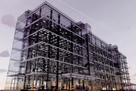
Building Information Modeling (BIM) is a digital approach to the design, construction and management of buildings and infrastructures. It is based on the use of a data-enriched 3D model, which is not simply a visual representation, but also integrates information on materials, dimensions, energy performance and all the building’s technical systems. This model thus becomes a centralized repository for the various players (architects, engineers, project owners) to work collaboratively on the same digital model.
The strength of BIM lies in its ability to cover the entire lifecycle of a building, from initial design to demolition or rehabilitation. In the design phase, it enables different configurations to be tested and any errors to be anticipated before construction. During the construction phase, BIM facilitates coordination between trades and reduces the risk of technical conflicts. Once the building has been delivered, the BIM model serves as a support for infrastructure management and maintenance, by integrating operating data such as equipment status and maintenance deadlines.
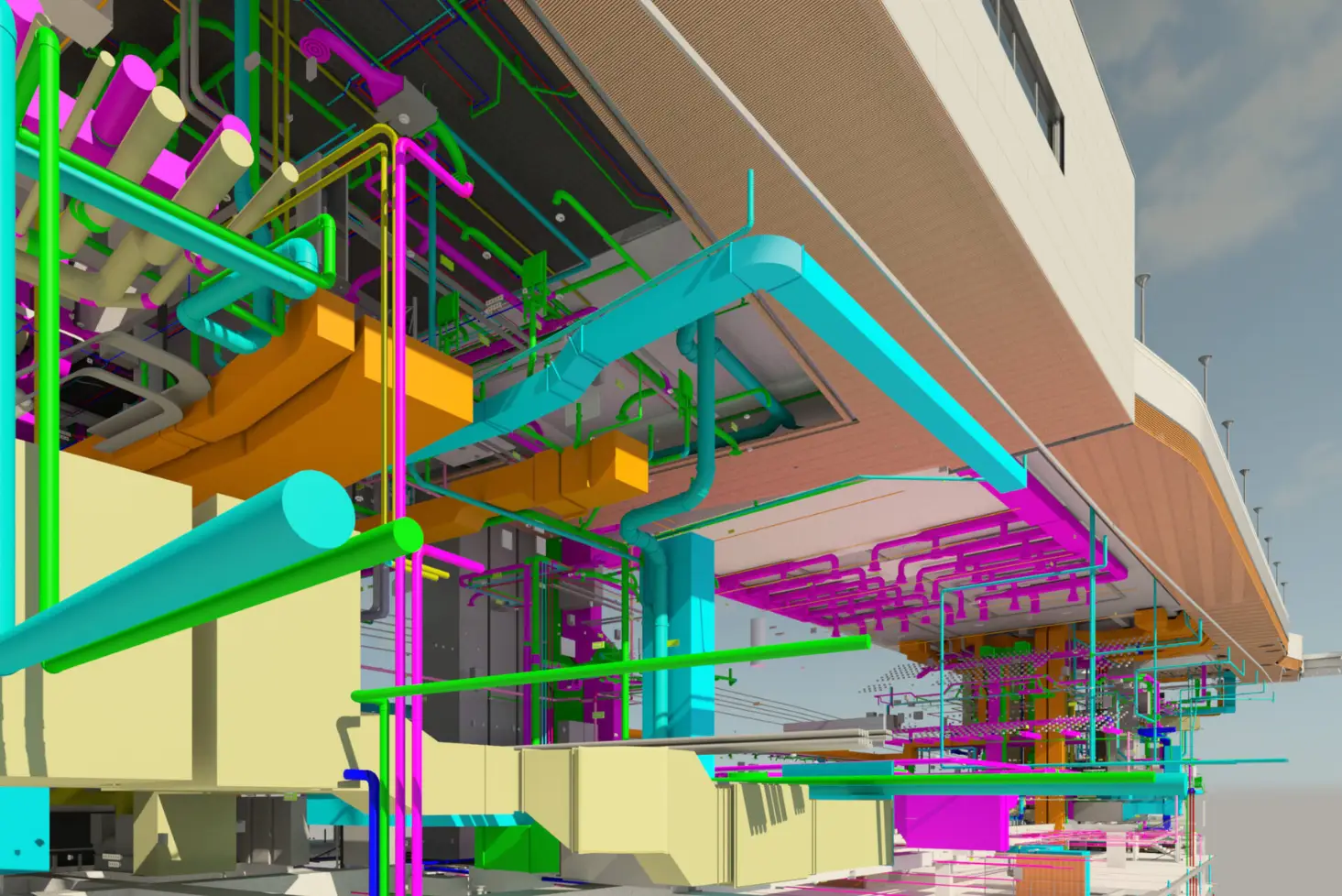
Beyond simple geometric modeling, BIM is also a decision-making tool for urban managers and local authorities. It can be used to optimize the energy consumption of buildings by integrating thermal analyses, to facilitate the planning of public spaces by simulating their use, and even to assess the impact of new construction on an existing neighborhood. By centralizing all data in a structured, interoperable format, BIM promotes a more rational and efficient approach to urban planning.
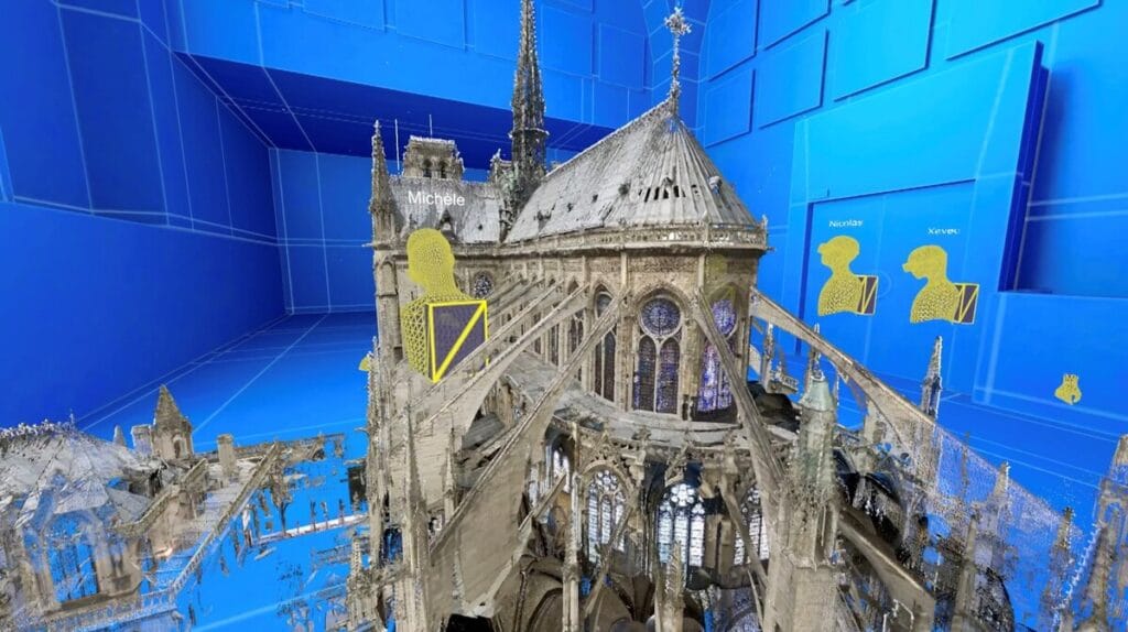
The digital twin
The digital twin represents a dynamic virtual replica of an entire building, infrastructure or territory. Unlike BIM, which is mainly used in the static design and management phase, the digital twin is continuously fed with data from sensors, connected objects (IoT) and operational databases. This evolving model makes it possible to constantly monitor the condition of a building or urban network, and to anticipate any anomalies or maintenance requirements.
In urban planning, the digital twin is an advanced simulation environment. For example, it can be used to analyze traffic flows based on traffic data, model the impact of weather conditions on a city’s infrastructure, or assess a neighborhood’s energy performance based on the behavior of its residents. These predictive and optimization capabilities are particularly valuable for smart cities seeking to better manage their resources and improve citizens’ quality of life.
Major metropolises such as Singapore and Dubai are already using these technologies to optimize their urban planning, making decisions based on precise, dynamic analyses rather than static projections.
Virtual Singapore: The first complete digital replica of a city
Virtual Singapore is an advanced digital platform that reproduces Singapore’s entire territory in three dimensions, integrating real-time data for intelligent urban management. Designed as part of the Smart Nation initiative, this digital urban twin enables urban planners, decision-makers and businesses to visualize the city in minute detail, analyze its functioning and virtually test scenarios before any real implementation. By harnessing technologies such as 3D modeling, artificial intelligence and the Internet of Things (IoT), Virtual Singapore is a powerful tool for optimizing regional planning, infrastructure management and urban mobility.
Beyond simple static representation, Virtual Singapore integrates dynamic data from urban sensors, geospatial databases and demographic information, making it possible to anticipate and solve a variety of urban challenges. For example, the platform can be used to model the impact of climate change on the city, analyze the spread of pollution, optimize traffic management or test new infrastructures before they are built. It also fosters interdisciplinary collaboration by bringing together government agencies, researchers and companies on a single platform.
Virtual Singapore serves as a digital testbed for smart city innovations. It enables new urban policies to be tested and evaluated without additional risk or cost. This pioneering project illustrates how urban digital twins can revolutionize metropolitan management by making cities more resilient, sustainable and connected, inspiring other major metropolitan areas to follow this path towards smarter, more proactive urbanization.
The London Underground in 3D Model
London has undertaken a major digital transformation of its transport network by integrating a digital twin of the Underground, developed in collaboration with start-up Spinview and Transport for London (TfL). This virtual model of the London Underground enables real-time monitoring of infrastructure, including tunnels, tracks and environmental conditions in the underground network.

By integrating data on heat, noise and carbon emissions, this digital twin helps to optimize maintenance, anticipate breakdowns and reduce the metro’s ecological footprint, with the aim of achieving carbon neutrality by 2030.
Practical applications of digital twins in urban planning
Digital twins are transforming the way cities are planned, managed and optimized. By integrating real-time data and advanced simulations, they provide a detailed and dynamic vision of the urban territory. From infrastructure management to citizen participation, these digital models make it possible to test different strategies before implementing them, reduce costs and maximize the effectiveness of urban policies.
Urban planning optimization: simulations and flow modeling
Thanks to these virtual models, urban planners can analyze traffic flows, the distribution of residential, commercial and industrial zones, and the impact of new infrastructures on the environment.
For example, before building a new road or neighborhood, authorities can use a digital twin to assess the impact on traffic, energy consumption and water management. This approach helps anticipate congestion points, optimize resource use and avoid costly mistakes.
Mobility and transport management: traffic jam prediction and infrastructure management
Transportation networks benefit directly from the digital twins that enhance urban mobility. By integrating data from sensors, GPS and transport applications, cities can simulate and anticipate traffic jams, adjust traffic lights in real time and propose intelligent alternative routes to users. Major metropolises such as London and Singapore are exploiting these technologies to smooth traffic flow and avoid bottlenecks. At the same time, public transport operators can adjust their frequencies and routes according to passenger flows to enhance the passenger experience while reducing operating costs.
Sustainable development: tracking CO₂ emissions and intelligent energy management
By integrating environmental data, they can monitor air quality, CO₂ emissions and the energy consumption of buildings and infrastructure. With this information, municipalities can identify the most polluted areas, implement emission reduction policies and optimize neighborhood energy consumption.
For example, some cities are using these models to test the impact of reflective materials or green roofs on reducing urban heat islands. By simulating different scenarios, decision-makers can make more informed decisions to improve energy efficiency and reduce the carbon footprint of urban spaces.
Safety and risk management: anticipating natural disasters
Digital twins are invaluable tools for crisis management and natural disaster prevention. By modeling areas at risk, they help anticipate the impact of floods, fires, earthquakes and other extreme climatic events. For example, by simulating the rise in water levels during an episode of heavy rainfall, the authorities can predict flood-prone areas, adapt drainage infrastructures and warn populations in advance. Similarly, for forest fire prevention, digital twins can be used to model the spread of flames according to weather conditions, and to plan preventive actions. These simulation capabilities help communities to make rapid decisions in emergency situations to minimize human and material damage.
Citizen participation: consultation and immersive visualization of urban projects
Digital twins promote greater transparency and citizen involvement in urban planning decisions. Thanks to interactive 3D visualizations, residents can explore current projects, understand the changes planned for their neighborhood and express their opinions at public consultations.
For example, some cities allow citizens to project themselves into immersive simulations using virtual reality, making it easier to understand future urban transformations. This interactive approach strengthens trust between municipalities and residents, making the planning process more inclusive and collaborative.
Don’t let the algorithm decide for you
Add Assistouest to your preferred sources on Google so you can find our guides faster when you search for an IT solution.
Smart Cities: Promising technologies but not without challenges
Although BIM and digital twins are transforming urban planning and infrastructure management, their large-scale implementation raises a number of challenges. These technologies, which rely on the collection, analysis and exchange of massive data, require tailored solutions to guarantee their reliability, interoperability and security. Major obstacles include real-time data quality, model standardization, and issues relating to cybersecurity and privacy.
Real-time data collection and quality
These systems rely on a multitude of information sources, from geospatial surveys and IoT sensors to administrative databases and existing BIM models. But ensuring that this data is updated accurately and continuously is a complex task. For simulations and analyses to remain relevant, information must be complete, accurate and synchronized. Inconsistencies, duplications or errors in databases can distort results and lead to inappropriate planning or infrastructure management decisions.
The challenge is to ensure consistent, usable data quality, enabling digital twins to be truly predictive.
Model standardization and interoperability
BIM and digital twins involve multiple players (town planners, architects, engineers, local authorities, infrastructure operators) who often use different proprietary software and formats. This diversity complicates the integration of data into a single, shared platform. Without a standardized framework, each entity risks working on its own model, limiting the benefits of a collaborative, cross-functional approach.
Efforts are underway to define open, universal standards such as IFC (Industry Foundation Classes) for BIM and CityGML for 3D urban data. However, these standards sometimes remain insufficient to guarantee full interoperability between platforms. Lack of harmonization can slow down the adoption of large-scale digital twins, and prevent data from being exploited seamlessly. It is therefore essential to promote common protocols and standardized repositories to enable the various players to collaborate and pool their models without loss of information or technical incompatibility.
Data security and privacy
Data security and protection are fundamental to the deployment of urban digital twins. These platforms aggregate a massive amount of sensitive data, including information on critical infrastructures, public buildings, population flows and sometimes even personal data linked to citizens’ movements. If this information is inadequately protected, it can be exposed to cyber-attacks, malicious use or violations of privacy.
The main challenge is tostrike a balance between opening up data and protecting it. On the one hand, digital twins must be accessible to public and private players to foster innovation and optimize urban services. On the other, strict cybersecurity protocols, such as access segmentation and regular audits, must be put in place. Data protection regulations(the RGPD in Europe) already impose strict restrictions on the collection and storage of personal information.